By Steven Gonzales, Executive Director of the El Camino Real de los Tejas National Historic Trail Association
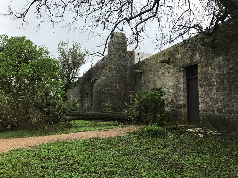
Hurricane Harvey took down or damaged over 200 trees in Goliad State Park.
(Photo courtesy Texas Parks and Wildlife Department)
On August 25, 2017, Hurricane Harvey made landfall on the Texas coast. Coming on shore just north of Corpus Christi as a Category 4 storm (130-156 MPH), the tempest headed in a northwesterly direction toward San Antonio before turning and heading east toward Houston and Louisiana.
With massive winds pushing it along its way, the storm dropped record-setting, torrential rains across vast swaths of both States. Some areas in Texas recorded over 60 inches of rainfall, requiring the National Weather Service to add new colors to its charts to accurately depict the deluge that was taking place, according to www.NPR.org. The extent of storm damage spanned from south Texas to western Louisiana and multiple trail sites were affected.
In south Texas in Goliad, roughly 50 miles from where the storm came ashore, the initial impact was massive. Storm winds knocked down centuries-old oak trees, ripped roofs from buildings, and tore down fences. Harvey also dropped 12-15 inches of rain on the community, causing flash-flooding in creeks and along the San Antonio River. Goliad State Park and Historic Site, a Camino resource that houses a Spanish mission built in 1749, was severely affected by the storm.
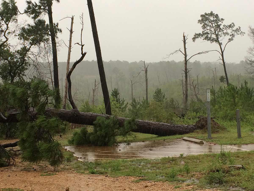
Trees down and flooding at Bastrop State Park.
(Photo courtesy Texas Parks and Wildlife Department)
According to the Texas Parks and Wildlife Department (TPWD), “The hurricane took down or damaged over 200 trees in the park. Most buildings were unhurt. However, the maintenance shop lost its roof and a storage building was heavily damaged. The park lost power. The San Antonio River was forecast to crest at 34 feet.” The park was completely closed from August 27 through September 23, when it partially reopened, though many areas still remain closed at present.
Further north, at Bastrop State Park near Austin, TPWD reported that some campsites and park roads were flooded and portions of Park Road 1C between Bastrop and Buescher were damaged. Bastrop State Park has swale remnants of the Camino and the park was also devastated by the Bastrop Fire of 2011, which decimated the Lost Pines of central Texas.
In far east Texas in San Augustine, near the Louisiana State line, flooding inundated the area and cut off access to Mission Dolores State Historic Site for over a day.
According to the site’s Facebook page on August 30, 2017, “Mission Dolores State Historic Site will be closed today due to inclement weather. (The site is) starting to see the impact of Hurricane Harvey in San Augustine, and the site is experiencing very heavy rains, which are beginning to cover our entrance road. Be safe out there! The three highway drainages are the main issues. The culverts under our entrance road are backing up and are sending water over the road. Ayish Bayou is 2 feet above flood stage and has jumped its banks. This is why we are closed.”
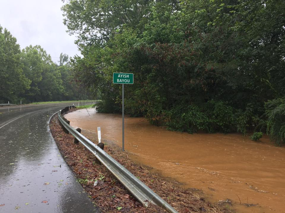
Flooding from Hurricane Harvey cut off access to Mission Dolores State Historic Site. (Photo courtesy Mission Dolores State Historic Site)
Hurricane Harvey was an intense storm of record, and the citizens of Texas and Louisiana are still working to recover from it. Luckily, while trail sites were heavily impacted by the storm, for the most part, they were only shut-down for a relatively short period of time, with no extensive damage to trail resources.
Just days before the storm hit, speaking of Presidio la Bahia, a fort that has stood in Goliad since 1749, ELCAT noted on our Facebook page, “Pictured here is Presidio la Bahia, the Presidio of the Bay, which has stood strong for centuries on the eastern end of the presidial line of defenses on the Northern Frontier of New Spain. We are sure the presidio and the residents of Texas will continue to endure as the storm approaches.” Let’s hope that this will remain true of all trail resources in the years to come, as they undergo the tests of Mother Nature, just as they have for centuries.
Unless otherwise indicated, all material in Pathways Across America is public domain. All views expressed herein are perspectives of individuals working on behalf of the National Trails System and do not necessarily represent the viewpoint of the Federal agencies.