

Established: October 3, 1980
Managing Nonprofit: Ice Age Trail Alliance
Managing Agency: National Park Service
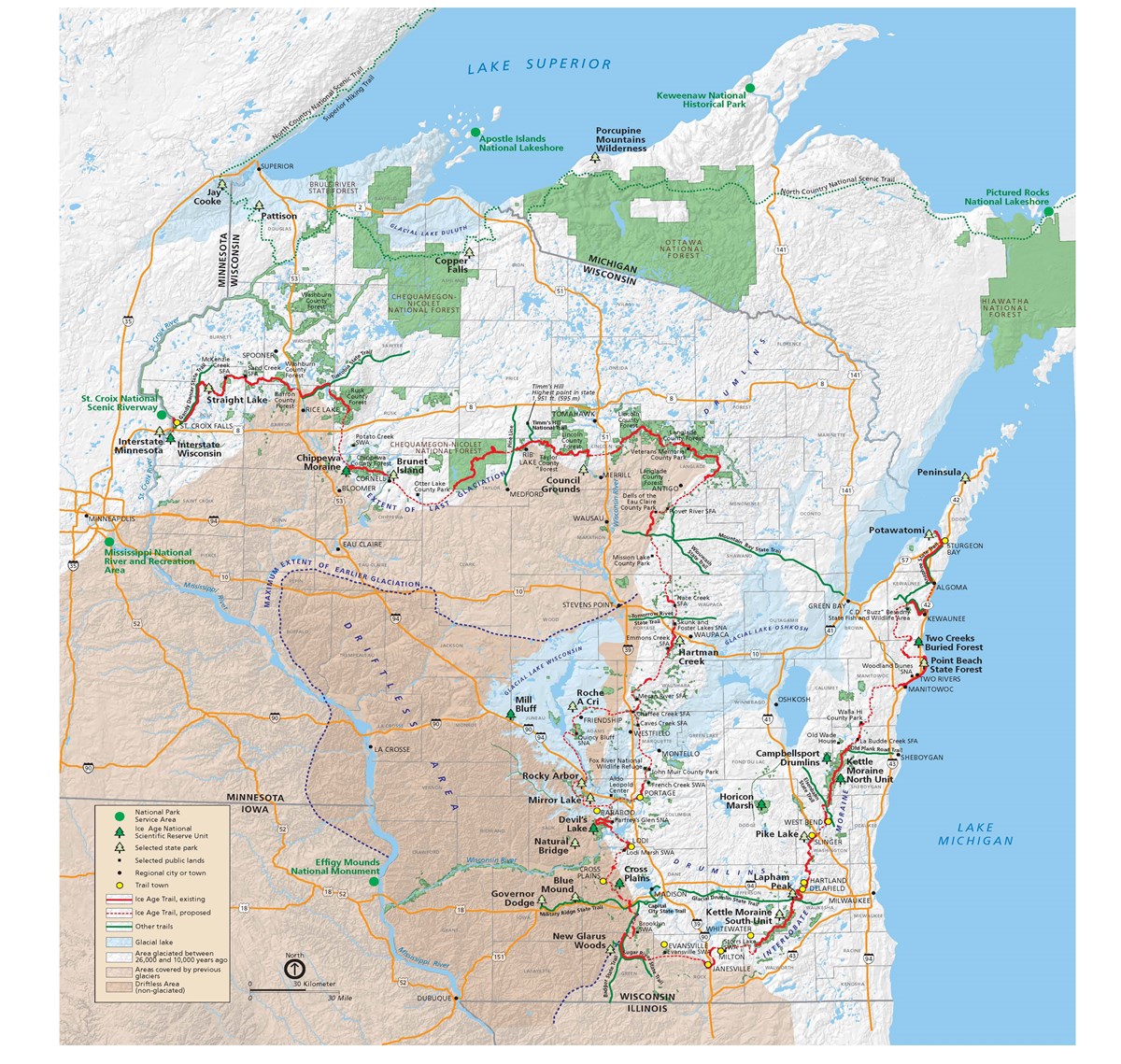
Ice Age National Scenic Trail Map courtesy NPS.
During the Ice Age that began about 2.6 million years ago and ended about 11,000 years ago, much of North America was covered by a single, enormous glacier. Remnants of that period remain in the State of Wisconsin in the form of lakes, river valleys, hills, and ridges. The Ice Age National Scenic Trail traces the edge of that glacier on its roughly 1200-mile course across the entire state of Wisconsin.
Northwestern Terminus: St. Croix National Scenic Riverway on the Minnesota-Wisconsin Border
Southeastern Terminus: Potawatomi, Wisconsin near Sturgeon Bay