by Kerry Shakarjian, GIS Specialist, National Park Service, Alaska
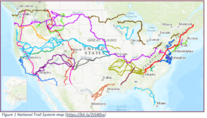
Figure 1 National Trail System map (https://bit.ly/2tS40vs)
There are 30 Congressionally designated National Scenic and Historic Trails (National Trails) covering more than 55,000 miles in total. The National Trails connect with 70 Wildlife Refuges, 80 National Parks, 90 Bureau of Land Management areas, 90 National Forests, 123 Wilderness Areas, and 100 major metropolitan areas (PNTS website, 2020). There are many additional miles of trail across the country.
In 2011, the Federal Trail Data Standard (FTDS) established a standardized set of trail terminology that can be consistently applied to trail data, enabling trail information to be shared across multiple agencies and partners. The FTDS addresses the universal need for trail data standards to efficiently manage trails, including National Trails, across the country.
Through discussions, it has come to the forefront that, in order to share information across multiple GIS systems nationwide, there needs to be agreement on how to implement and utilize the FTDS for ease of sharing and aggregating trail GIS data nationwide.
Using the FTDS as the foundation, a Federal Trail GIS Schema template has been developed that can be utilized by agencies and partners to establish a unifying and common trail GIS data structure. As the FTDS was intended, the Federal Trail GIS Schema is meant to be applied to trails of all kinds, including National Trails. The Federal Trail GIS Schema will allow for national aggregation of publicly facing trail data from multiple agencies and partners into a common schema GIS database, such as the USGS National Digital Trails Project.
The Federal Trail GIS Schema was designed as a framework and a minimum requirement of core fields for all trail spatial data. During the schema design, the focus was on utilizing this template schema as a tool for aggregating publicly facing trail data. Keeping publicly facing data in mind, not all attributes from the FTDS were included. The schema is flexible enough to allow for additional custom fields to be added at the trail GIS manager’s discretion, including any additional FTDS fields not included in the Federal Trail GIS Schema.
The Federal Trail GIS Schema includes a geodatabase template containing two different line geometry feature classes, as well as a point geometry feature class. The first line geometry feature class template is called Core, which includes the minimum attribute fields required for all trails. The second feature class template is called Extended Core, which includes the Core fields as well as the minimum attribute fields required for National Scenic and Historic Trails. The third feature class template is called NHT Sites and includes the minimum attribute fields required for all National Historic Trail Site locations.
Each feature class schema includes an additional framework, known as feature level metadata, for documenting the lineage and quality of the geospatial data at the feature level. These templates are a starting point. Adding additional attribute fields are encouraged.
Overall, a Federal Trail GIS Schema would make it achievable to have better GIS coordination and collaboration between agencies and partners for various trail projects, efficient sharing of authoritative trail data with the public, and better GIS decision-making support for trails.
Please visit communities.GeoPlatform.gov/ngda-transportation/federal-trail-gis-schema-working-group for more information and to download the current draft documentation and draft GIS geodatabase template.