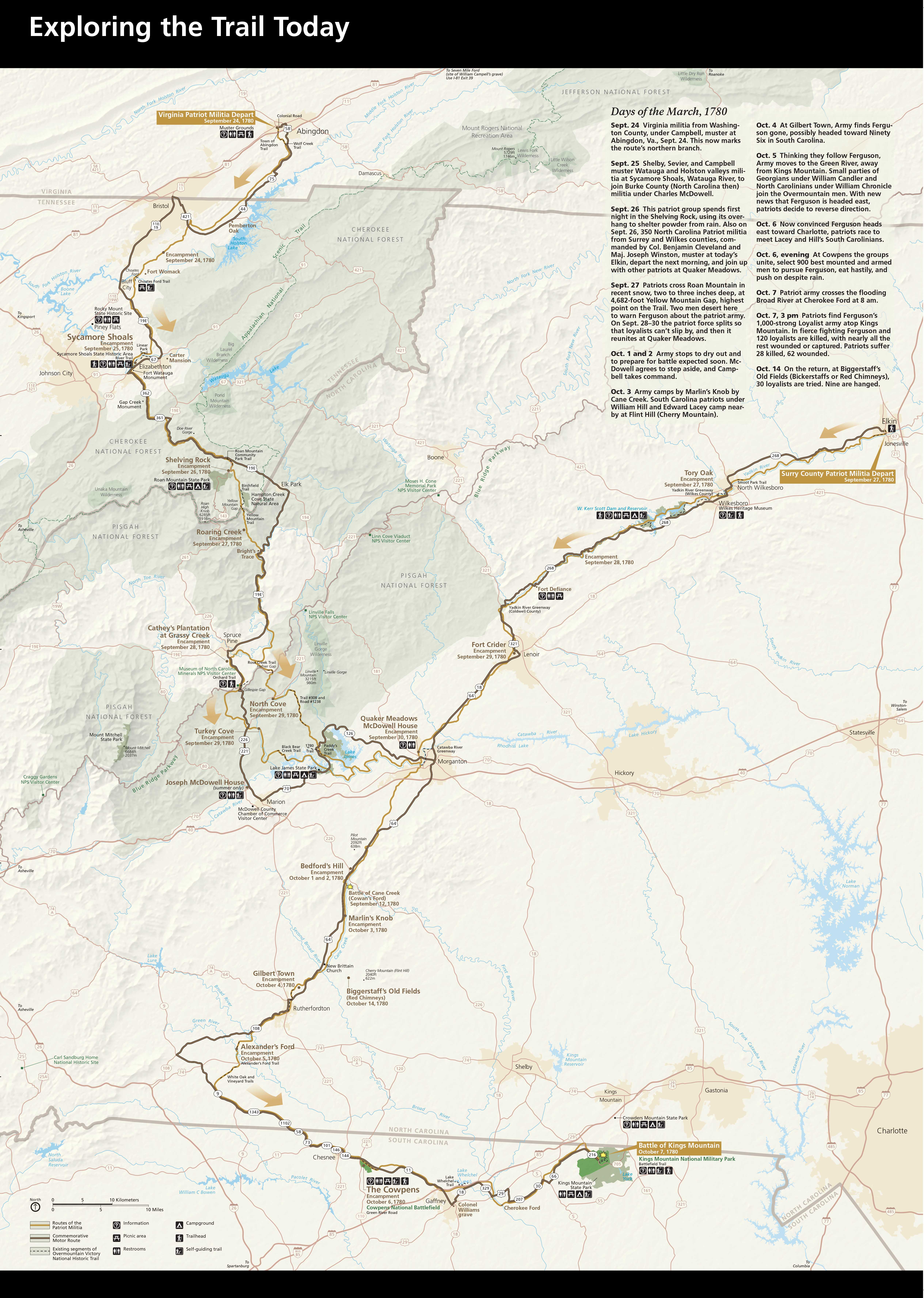

The Overmountain Victory National Historic Trail traces the route used by the patriot militia during the pivotal Kings Mountain campaign of 1780, which led to a turn in the tide in favor of American forces during the American Revolutionary War.
Northern Terminus: Colonial Road in Abington, Virginia
Eastern Terminus: Elkin, North Carolina
Southern Terminus: Kings Mountain Nation Military Park / Kings Mountain State Park in northern South Carolina.
The Overmountain Victory Trail includes two northern branches that pass through Virginia, Tennessee, and North Carolina, as well as a southern branch that begins in the northern reaches of South Carolina and heads northward into North Carolina. The trail includes marked highway as well as 87 miles of walkable pathways.
