The Pacific Crest Trail Association (PCTA) provided the following highlights for the Pacific Crest NST during the 2021 calendar year:
Collaboration and Engagement
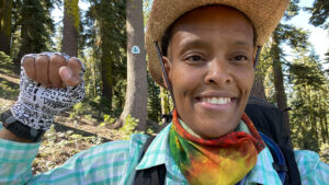
Crystal Gail Welcome: photo by Crystal Gail Welcome.
The PCTA sponsored Crystal Gail Welcome’s “Footprints for Change Hike for Justice” this summer on the Pacific Crest Trail portion of the Great Western Loop. Crystal shared her experience in PCTA’s Communicator magazine and on the organization’s blog (https://www.pcta.org/author/cgail/), to encourage members of the PCT community to become more aware and more mindful of ourselves.
After a lengthy battle with a rare brain disease, Crystal Gail Welcome came to recognize the healing power of nature. She now uses her experience to break down barriers so more people can access the outdoors. Crystal is an experiential educator, author, storyteller, activist, backpacker, and Black outdoor leader. She chooses to speak out against racial injustice in the United States by hiking and giving voice to her experiences.
In her first blog post for PCTA, Crystal wrote, “The systems of oppression and disadvantages that excluded BIPOC (Black, Indigenous, and People of Color) from the outdoors is detrimental to the future of our trails and our planet. As humans, our experience with the land reflects how we treat it, a meaningful connection with Nature instills a desire to protect it and maintain her.
“I think about the future of the trails and of our Earth. I know for a fact I want us to have both—and I want them to thrive. For that to occur, people must work to maintain our trails and protect Nature. This starts with relationships to the Earth and with one another.
“Today I invite everyone to start a new relationship with a trail and a human. Walk a trail, attend a trail clean up, and get to know your neighbor in the process.”
Education, Interpretation and Cultural Expression

Screenshot of PCTA interactive map courtesy of PCTA.
- PCTA launched a new interactive map of the Pacific Crest Trail (https://www.pcta.org/discover-the-trail/maps/). The map shows the trail itself, and includes a wide variety of switchable map layers such as mile markers, trail towns and resupply locations, permit areas, Indigenous lands, national forests and wilderness areas, satellite imagery, wildfire perimeters, air quality, and more.PCTA GIS Specialist Galen Keily says, “As a map guy, I’m really excited about it, but I think more than just us map nerds will be too. Our aim is to make the trail more accessible to folks who are planning, following along, or even currently on the PCT. It’s also an incredibly useful tool for our staff and volunteers.”One of Galen’s favorite features is the ability to draw points, lines, and shapes, then print your map to a PDF or an image. “Just like that, you’ve made a custom map that you can email to a friend, post online or carry with you”, he says.PCTA hopes the map helps more people discover the vast richness of the PCT and fall in love with the Trail.
- The USDA Forest Service and the PCTA work together to help minimize the increasing effects of a growing number of PCT users, especially during the peak thru-hiking season. In 2017 this partnership introduced the volunteer position of Southern Terminus Trailhead Host. After being put on pause in 2020 due to the COVID-19 pandemic, in 2021 the partnership expanded and welcomed volunteers at a second location, Kennedy Meadows on the Inyo National Forest.Hosts are a vital resource to trail users, answering last-minute questions and sharing important trail information, like water sources. Their goal is to reduce human-caused damage to the trail through education, awareness and empowerment. They also collect valuable information that helps to inform future stewardship of the PCT.
Other Highlights
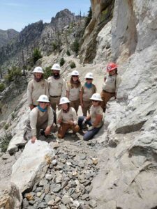
American Conservation Experience crew on the cleared trail. Photo by PCTA staff.