

Washington-Rochambeau Revolutionary Route National Historic Trail
Established
March 30, 2009
Nonprofit Partner
Washington Rochambeau Revolutionary Route Inc. (W3R)
Administering Agency
National Park Service

About the Trail
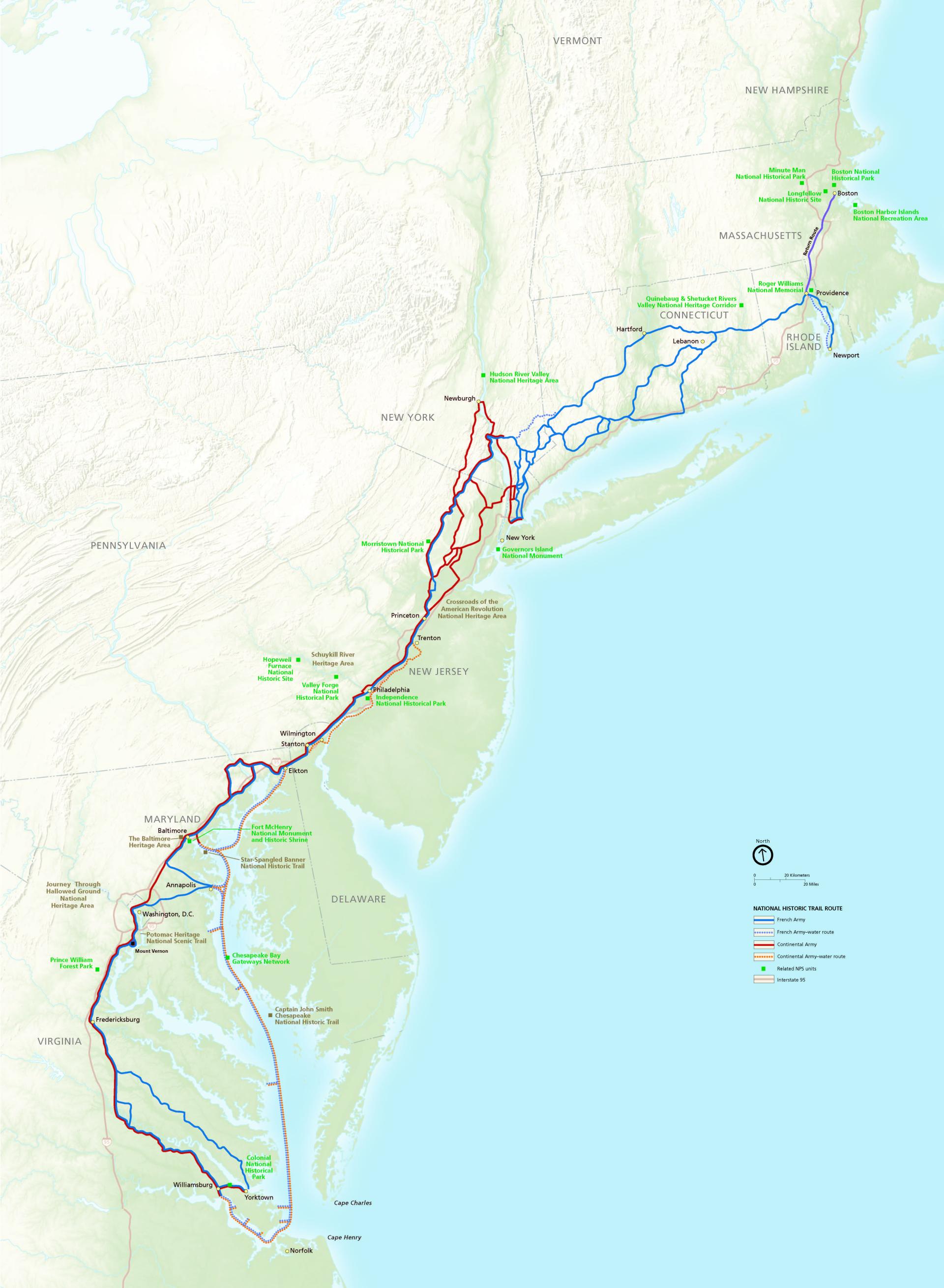
The Washington–Rochambeau Revolutionary Route National Historic Trail follows the land and water routes used by American and French forces during the 1781 march from Newport, Rhode Island, to Yorktown, Virginia. The trail commemorates the Franco-American alliance and the campaign that helped secure victory at Yorktown during the American Revolution.
Notable historic sites along this National Historic Trail include George Washington Birthplace National Monument, Boston National Historical Park, and Independence National Historical Park. Discover additional points of interest along the trail here.
Southern Terminus: Yorktown, Virginia, near Colonial National Historical Park.
Northern Terminus: North of Boston, Massachusetts, near Boston Harbor Islands National Recreation Area.
The national historic trail extends more than 600 miles through Massachusetts, Rhode Island, Connecticut, New York, New Jersey, Pennsylvania, Delaware, Maryland, Virginia, and Washington, D.C. The main trail and its multiple side routes pass through major metropolitan areas in the Boston-New York-Washington corridor. Along the way, the trail connects communities, historic landscapes, encampments, waterways, parks, historic sites, natural preserves, and other public open spaces that help tell the story of the Franco-American alliance, the American Revolution, and the march to victory.