by Matthew Nelson, Executive Director, Arizona Trail Association
Maintaining and protecting the Arizona National Scenic Trail (AZT) has always been a challenge, especially considering the diversity of ecosystems the trail traverses. Through deserts, canyons, mountains, and forests, the AZT climbs and descends over 110,000 feet in only 800 miles and showcases nine of the state’s 11 bioregions.
Over the past decade, the impacts of climate change have been glaringly obvious and increasingly alarming. The wildfire season has extended from four months to eight months, and water sources that have been historically reliable are disappearing. In an effort to fulfill our mission, the Arizona Trail Association (ATA) has been studying the best available science and adopting resiliency models to ensure the long-term sustainability of the AZT.
Wildfires
Every year we watch in horror as Arizona’s volatile wildfire season wreaks havoc across the landscape. In the past, this season of worry (and trail closures) started in May and was usually over by August. But over the past few years we’ve seen wildfires start as early as March and extend through October. With highly variable seasons that defy our previous understanding of precipitation and the terrain’s proclivity to combustion, it has become increasingly difficult to predict when fires may begin, how long they’ll last, and their impacts to watersheds, communities and the trail.
In June, the Woodbury Fire started from a lightning strike in the Superstition Wilderness. Fueled by tall grasses that covered the landscape from a very wet winter and driven by hot summer winds, the fire grew exponentially every day until it consumed the entirety of the mountain range. In all, 123,000 acres were incinerated and over 60 miles of recreational trails were lost. Thirty miles of the AZT were impacted by the Woodbury Fire, and the safety hazard of flash floods within a burn scar have prevented U.S. Forest Service and ATA staff from entering the wilderness area to conduct a proper conditions assessment.
The AZT’s typical southbound thru-hiking season began in mid-September and it’s still unclear whether or not hikers will be allowed to travel through the Superstition Mountains. Because the fire impacted all of the trails within the wilderness, there is no viable detour. Many will rely on passing motorists to transport them from Roosevelt Lake to the Town of Superior. The good news is that the Tonto National Forest secured $105,000 in Burned Area Emergency Response funding, and Conservation Corps will be deployed in October for critical trail repairs, deadfall removal, sign installation, and hillside stabilization efforts.
In an effort to minimize future catastrophic wildfires, the ATA is supportive of forest health initiatives, including selective thinning and prescribed burning. While the immediate impacts detract from the AZT’s scenic qualities, the health of our forests is paramount for the trail’s sustainability.
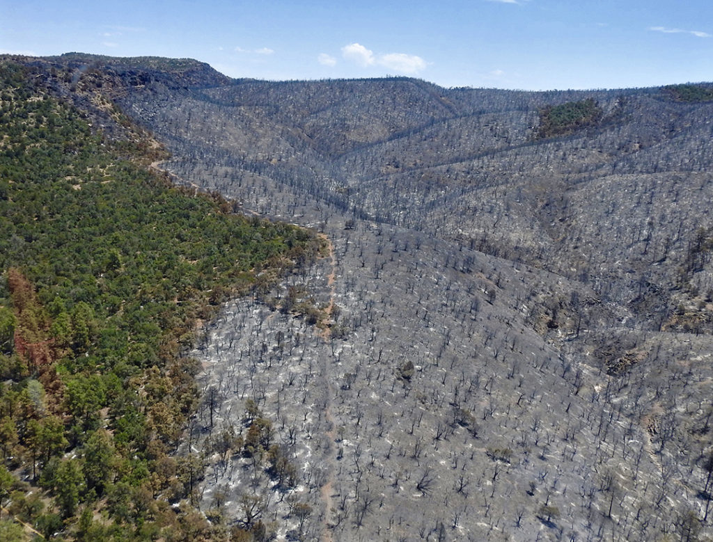
This summer, the Woodbury Fire consumed 123,000 acres of the Tonto National Forest and 31 miles of the Arizona National Scenic Trail. (Photo Credit: Tonto National Forest)
Detours
When detour options exist to temporarily route the trail around wildfire closures or prescribed burns, the ATA uses a variety of communication tactics to inform trail users how to find their way around closures along the safest and most scenic routes possible. These include:
- Official “AZT DETOUR” signs placed along the routes (these are durable plastic, reusable, and can be nailed to trees or zip tied to existing sign posts)
- Alerts and detour routes added to the Guthook smartphone app
- Social media announcements with maps and written descriptions
- Updates posted to the ATA website, online forums, and shared through eNewsletter
- Information provided to trail stewards and Gateway Community representatives, who are often primary points of contact for trail users
- Detour notices at trailheads and/or access points immediately north and south of the affected area
Improving Water Sources
A long-distance trail without water is irrelevant, and is simply not sustainable. The ATA has invested in numerous projects to enhance water sources along the Arizona Trail, including installation of bear boxes so trail users can cache water; identifying and signing water sources within a half mile of the trail; rehabilitating springs negatively impacted by erosion, cattle, and wildfires; and most recently, construction of a remote rainwater collector.
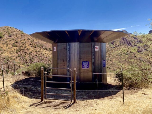
The AZT Rainwater Collector will store up to 1,500 gallons of fresh rainwater for trail users along a particularly dry segment of the Arizona NST. (Photo Credit: Zara Bauer)
On August 31, 2019, a dedicated crew of staff and volunteers braved the heat of summer to install the first remote AZT Rainwater Collector. This unit is the first of its kind and was designed by the ATA and metalsmith extraordinaire Rob Bauer in consultation with sustainability professionals, land managers, and engineers.
The rainwater collector features a steel apron that catches rainwater and stores the precious resource within a 1,500-gallon tank that is protected on all sides by steel panels. A spigot with an automatic shutoff valve allows trail users to fill and filter their bottles. Once the tank is full, an overflow pipe fills a steel water trough nearby for the benefit of wildlife. The entire unit is fenced to keep livestock out, and posted signs inform trail users that the water must be filtered before consumption.
Since it is not visible while on the trail, it doesn’t detract from the Arizona Trail’s scenic values. It sits at ground level and no disturbance was necessary for its installation, unlike wildlife water projects that require a large footprint and significant ground disturbance. The steel panel construction is literally bulletproof and will require minimal maintenance over many decades.
The collector will likely fill during summer monsoons for trail users to tap into during the busy autumn trail season. The pattern will be repeated with winter moisture refilling the tank for the spring season. Water quality will be studied over a period of one year by the University of Arizona’s Project Harvest students, and those results will be shared on the ATA website. Since rainwater is essentially distilled and the unit features a three-stage screen system, it’s unlikely any natural contaminants will find their way into the storage tank. The water never receives direct sunlight, so algae will not grow. Unlike most tanks, streams, ponds, and other sources along the AZT, cattle will have no opportunity to contaminate the water. Fine mesh screens cover the intake and outflow to prevent mosquitoes, bees, and other insects from accessing the water source.
The AZT Rainwater Collector was funded by a Restoration and Resilience Grant from the National Environmental Education Foundation (NEEF) and Freeport-McMoRan Copper & Gold Foundation. After studying this pilot project for one year, the ATA will consider fabricating and installing other rainwater collectors along the driest segments of the AZT.
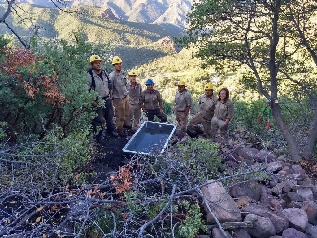
The Arizona Trail Association recently installed water collection troughs in the Mazatzal Mountains. (Photo Credit: Roger Smith)
Unless otherwise indicated, all material in Pathways Across America is public domain. All views expressed herein are perspectives of individuals working on behalf of the National Trails System and do not necessarily represent the viewpoint of the Federal agencies.