Last year, National Scenic and Historic Trails across the US continued to protect land, mobilize communities, and advocate for wildlife, ecosystem health, climate resilience, and Indigenous heritage.
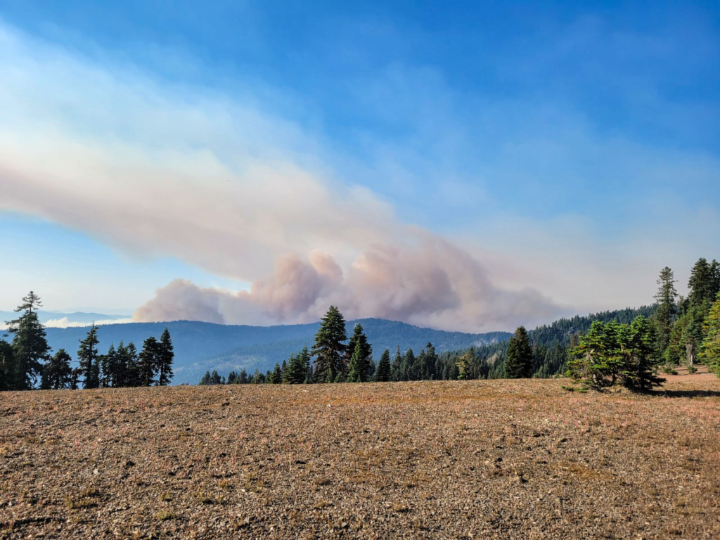
McKinney Fire from the Pacific Crest Trail. Photo by Jen Olson.
Many trail organizations took bold action toward acknowledging the impact of climate change on the Trails System and imagining new ways to mitigate it. The Appalachian Trail Climate Advisory Group (CAG) created the Appalachian Climate Corridor Report advocating for the Appalachian landscape’s potential to achieve governmental climate and conservation goals. CAG consists of the Appalachian Trail Conservancy (ATC) and members of leading conservation organizations and academic institutions in the United States, including the National Park Service, the Volgenau Foundation, and Harvard University. The landscape, made up of approximately 179 million acres, is only 26% permanently protected, leaving it vulnerable to degradation and diminishing its ability to be a significant mitigator of climate change. With the Appalachian National Scenic Trail at the heart of this landscape, an increase in conservation and climate mitigation efforts would protect the recreational and cultural uses of the Trail and help preserve biological diversity. The report builds awareness of climate change threats and highlights climate action opportunities to safeguard the region’s public safety, economic stability, and ecological health. It is a tool to integrate climate-smart actions into conservation strategies and strategic planning efforts, and it demonstrates the potential within the Appalachian landscape to help achieve ambitious goals set by the U.S. government related to conservation, environmental justice, and the climate crisis.
On the other side of the United States, climate change impacts on the Pacific Crest National Scenic Trail (including wildfire and drought) are being directly addressed by the Pacific Crest Trail Association (PCTA). Climate change impacts on the PCT (including wildfires, extreme drought, and increasingly erratic extreme weather events) are being directly addressed by The Pacific Crest Trail Association (PCTA), which has made a commitment to promote the impacts of climate change on the trail. They partnered with PCT hiker Brad Marston, a climate scientist at Brown University, and John P. O’Brien, a climate scientist at the Lawrence Berkeley National Laboratory’s National Center for Atmospheric Research, to write an article about climate change and the PCT experience. Their
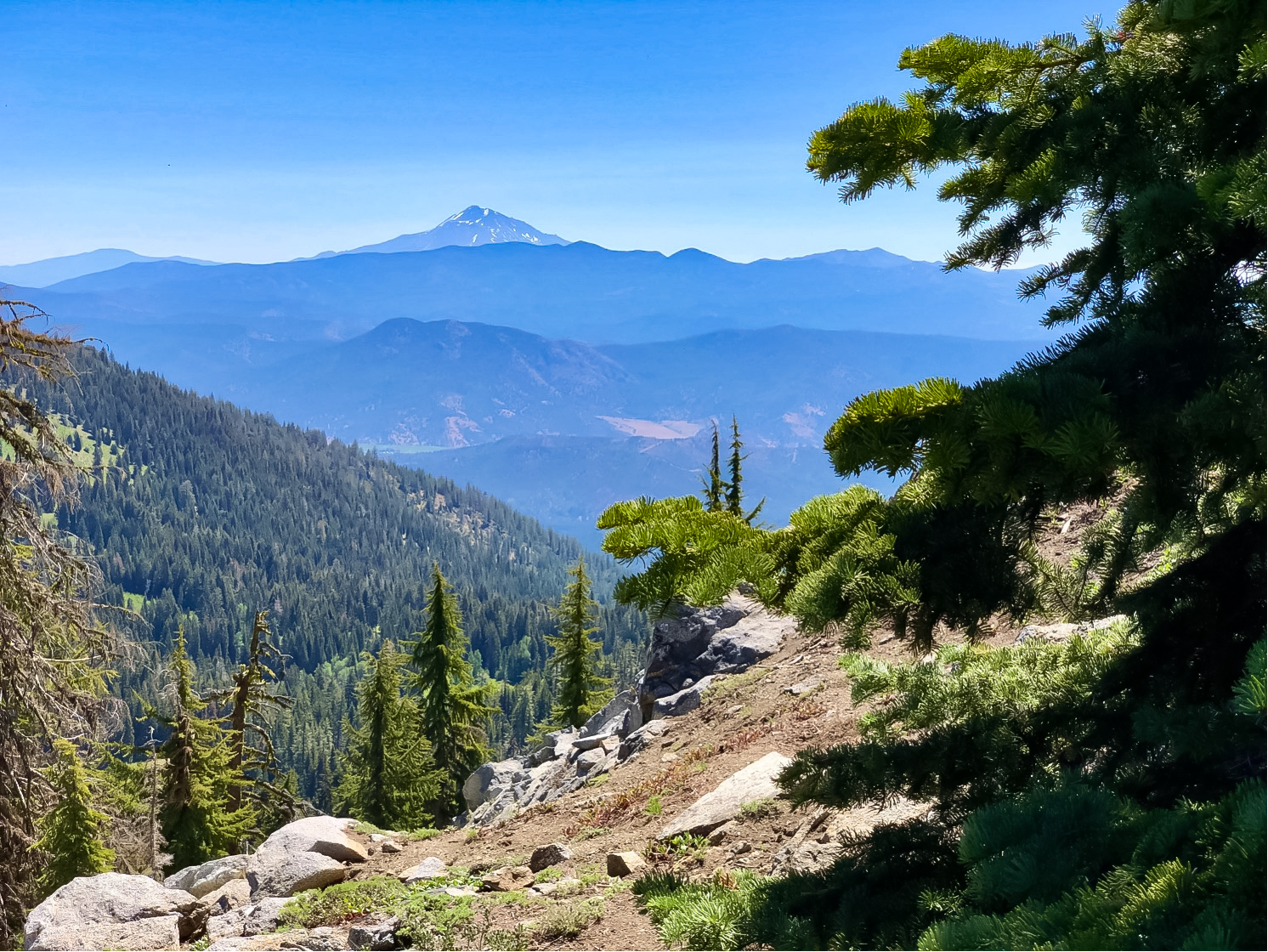
Snowless Mt. Shasta. Photo by Brad Marston.
story was published in the spring issue of the PTCA magazine and widely shared on a global scale.
The Continental Divide Trail Coalition (CDTC) published the Connecting Across the Continent Report, which sets the Continental Divide National Scenic Trail (CDT) as an anchor for having conversations around large landscape conservation. It demonstrates how the CDT and the National Trails System can provide a path forward for reaching aspirational conservation goals such as elevating locally-led climate solutions.
Land protection is evolving as trail organizations work to return the land to its original Indigenous stewards and include Indigenous history in trail management. The Lewis and Clark National Historic Trail, in collaboration with the National Park Service National Historic Landmark (NPS-NHL) program, initiated a project to update the National Register Nomination for the Lolo Trail National Historic Landmark to include Indigenous history and use, which has been previously excluded in the nomination. The NPS, partnered with the Library of Congress, produced a draft Letter of Inquiry to the Keeper of the National Register of Historic places, which will be the first step in updating the nomination.
The Appalachian Mountain Club (AMC) developed a Land Protection Strategy for the New England National Scenic Trail in Massachusetts with the expert facilitation of Don Owen. They convened with the intention of securing a continuous, permanently protected corridor of land in Massachusetts from the Connecticut border to the New Hampshire border.
The Chesapeake Conservancy and US Fish & Wildlife Service acquired 465 acres of land to protect Fones Cliffs along the Captain John Smith Chesapeake National Historic Trail. The land was then returned to the Rappahannock Tribe, which plans to build the infrastructure where tribal members can provide education on their history and Indigenous approaches to conservation. This land will connect future generations of Rappahannock youth to their tribal traditions. Later in the year, the Conservation Fund acquired an additional 964 acres along the Rappahannock River to continue to protect Fones Cliffs, a key feature along the Trail.
Hundreds of acres of land were acquired and protected last year. The Ice Age Trail Alliance has protected 3 key additions to the Ice Age National Scenic Trail, allowing for progress toward completing the Trail. Three trail easements were donated by a dedicated trail volunteer, permanently protecting land that will eliminate nearly three miles of connecting routes. Property owners in Manitowoc County sold 80 acres to the Alliance, which they stated is “too precious for development.” Finally, a 40-acre parcel of woodlands was sold to the Alliance this year, which will soon host a new section of the Ice Age Trail and a dispersed camping area. The New England National Scenic Trail acquired a new trailhead and 23-acre park that was once at risk of becoming a subdivision in Easthampton, MA . The park includes a parking lot, a gravel trail leading an overlook with accessible picnic tables, a short loop trail, interpretive signage, and two kiosks. From th
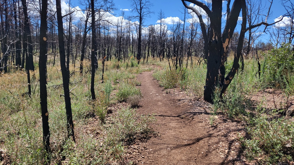
Mangum Fire trail construction: Photo by Arizona Trail Association. After a two-year closure order following the
Mangum Fire, a 3-mile segment of the Arizona NST was built in 2022 to avoid the severely-burned canyon bottom.
e overlook, a reroute leads to the New England Trail. An additional section of the Trail is now protected after the Wallingford Land Trust acquired a 14-acre Boy Scout property, which may allow for the development of an overnight site for backpackers. In October 2022, President Biden designated Camp Hale–Continental Divide National Monument in Colorado, protecting over 20 miles of the Continental Divide National Scenic Trail. Ala Kahakai Trail Association acquired over 1,800 acres of land at Kiolaka`a in Ka`ū to protect and preserve the Ala Kahakai National Historic Trail, cultural and natural resources as well as the view plane along the coast.
Wildfires have been one of the most devastating impacts of climate change and drought on the National Trails System in the last decade, and many trails took action to mitigate the impacts in 2022. The Orderville Canyon segment of the Arizona National Scenic Trail was closed for two years after the 2020 Mangum Fire. In 2022, 3 miles of new trail were built in a more sustainable location. In response to the Caldor Fire of 2021, the National Pony Express Association has been working with many organizations and Federal departments to determine the best way to fund and implement the restoration of 5 bridges and 20 miles of the Pony Express National Historic Trail that was damaged in the fire. The Performance and Work Based Learning crews logged out 5,180 fallen trees off the Pacific Northwest National Scenic Trail in 2022, the majority being in designated wilderness areas where the use of chainsaws is prohibited.