![]()
Established: November 10, 1978
Managing Nonprofit: Continental Divide Trail Coalition, Continental Divide Trail Society
Managing Agency: USDA Forest Service
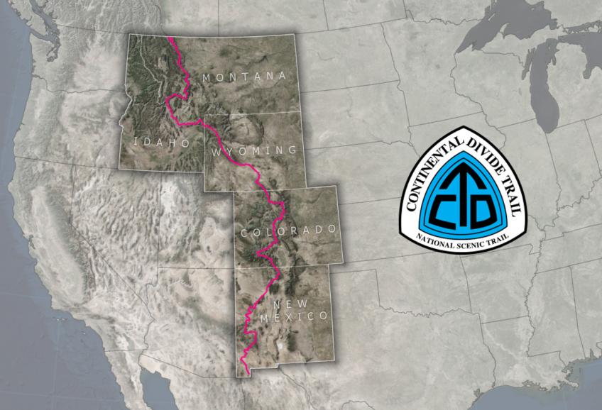
Map of the Continental Divide National Scenic Trail courtesy USDA Forest Service.
The Continental Divide is an imaginary line that divides the North American continent in half. Water that falls to the west of that line eventually drains into the Pacific Ocean, and waters that fall or flow to the east of that line eventually make their way to the Atlantic Ocean. The Continental Divide National Scenic Trail (CDNST) traces the Continental Divide through the continental United States, from Mexico to Canada. The CDNST is one of three trails that a person has to thru-hike to earn the title of “Triple Crowner”. The other two “Triple Crown” trails are the Pacific Crest National Scenic Trail and the Appalachian National Scenic Trail.
Northern Terminus: Glacier National Park at Waterton Lake, Montana
Southern Terminus: Crazy Cook Monument, New Mexico
The Continental Divide National Scenic Trail follows the route of the Rocky Mountains through five states: New Mexico, Colorado, Wyoming, Idaho, and Montana. The trail meanders through low deserts near Mexico, into the Mountains of Colorado, then through grasslands of Wyoming and Idaho before reaching the forests of the US/Canada border.