By Steven Gonzales, Executive Director of El Camino Real de los Tejas National Historic Trail Association
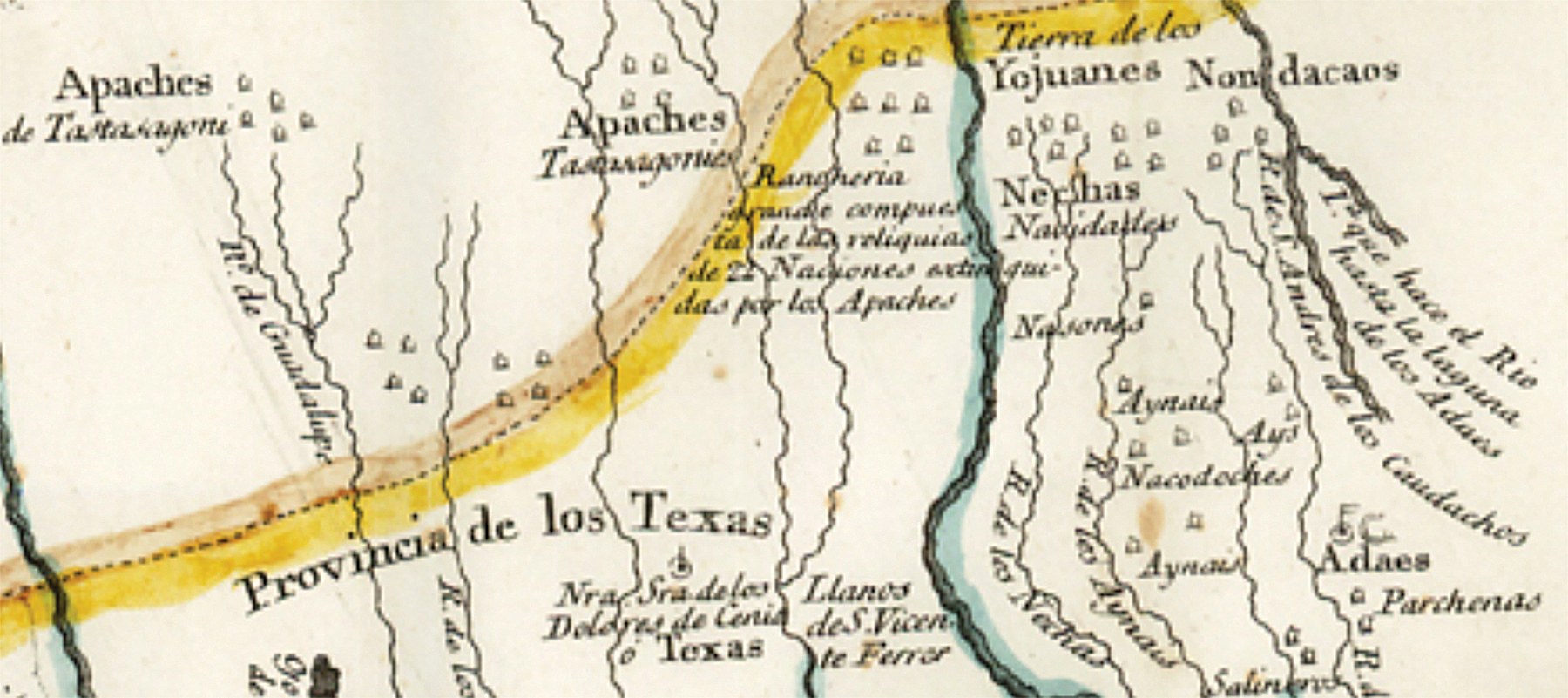
This 1768 Spanish map illustrates the path of the Camino and the location of the Rancheria Grande in historic times.
(Photo courtesy Steven Gonzales)
El Camino Real de los Tejas National Historic Trail Association (ELCAT) received a Texas Preservation Trust Fund grant from the Texas Historical Commission (THC) for their Rancheria Grande archaeological project in Milam County, which is about 75 miles east of Austin. The matching grant, awarded in October 2016, is funded by the THC at $30,000 for a total of $60,000 toward the project.
Working to highlight the history of Rancheria Grande, ELCAT and archaeological firm GTI Environmental have been conducting archaeological investigations in the Rancheria since late 2016, and many exciting discoveries are taking place. The Texas Parks and Wildlife Department has also filmed the archaeological efforts in the Rancheria for their weekly PBS series, and the segment will air in February 2018.
Historical perspective
The earliest history of Colonial America is intrinsically linked to early Texas history, which represents shared ideas of liberty between Spanish, French, and English colonists. The history of the United States begins in early Texas history as much as it does in the 13 American colonies. The story of the Rancheria Grande rivals the narrative of Plymouth Rock and Jamestown, and all three with the Spanish Missions ranchos of La Provincia de los Tejas are equally responsible for the successful colonization of North America.
The Rancheria Grande represents the largest conglomeration of Native American and European groups that assisted in the transportation of goods, soldiers, ammunition, funding, and cattle to the American Revolutionary war effort. Social and economic ties were required to pass safely along El Camino Real de los Tejas through Rancheria Grande territory; without good relations with the 23 nation groups, our national narrative might have been very different than it is today.
Archaeological findings
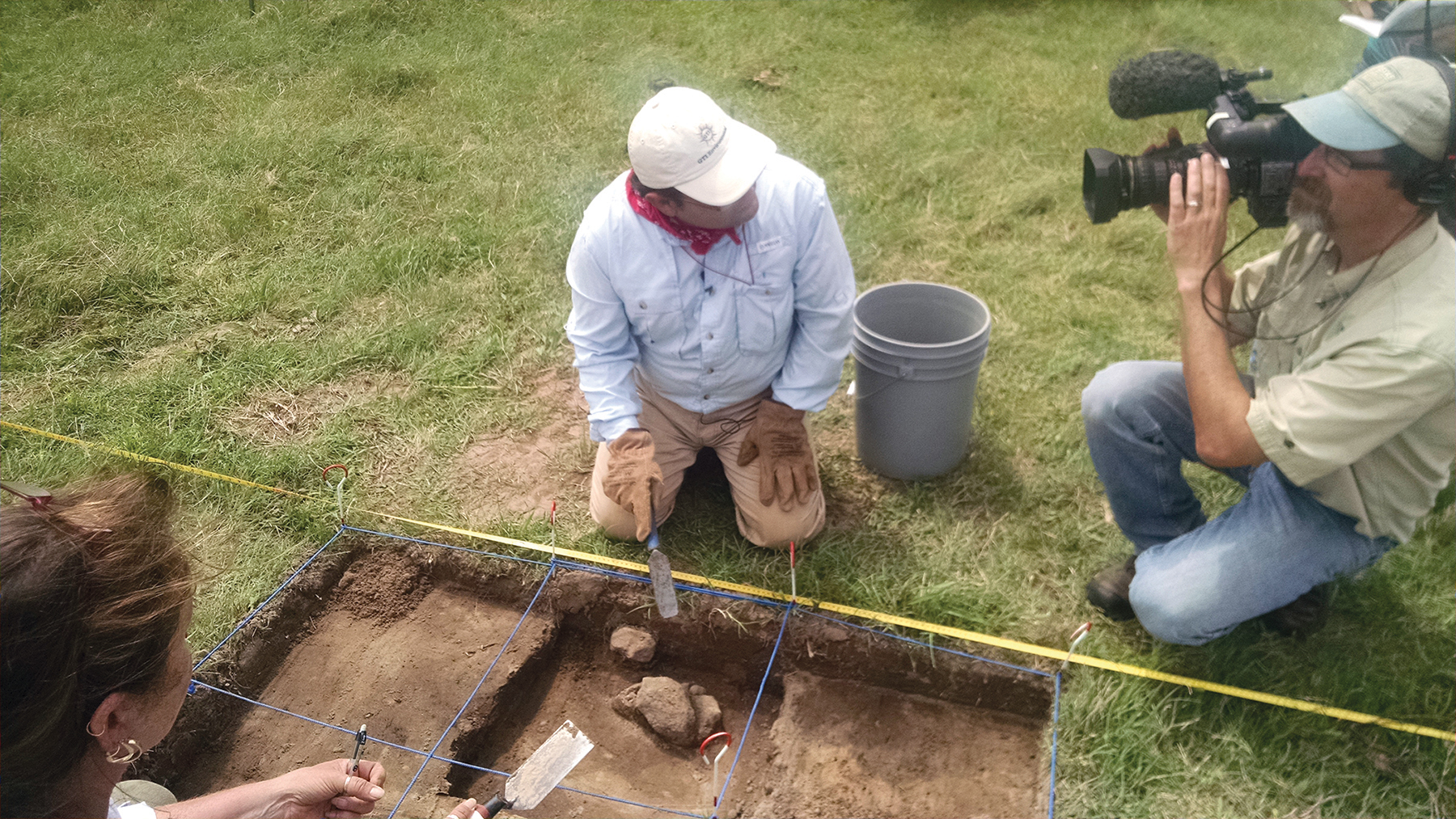
Sergio Iruegas of GTI Environmental conducts shovel tests in the Rancheria Grande while being filmed by Alan Fisher of the Texas Parks and Wildlife Department for its PBS series.
(Photo courtesy Steven Gonzales)
In the fall of 2016, an extensive swale of the Camino was discovered on the Conner property within the Rancheria. Known as the Conner Swale, the remnant is several hundred feet in length and is in alignment with the official National Park Service trail line. The Conners have since cleared the undergrowth and restored the swale to its historic setting. They have guided tours of their property, in conjunction with the Texas Master Naturalists, and they anticipate incorporating Camino history and viewing of the swale into their tours.
Even more exciting, in March 2017, evidence of multiple Native American dwellings were discovered on the Bauman property, which is adjacent to the Conner property.
According to GTI Environmental: “(GTI has) found the archaeologically documented presence of midden deposit, a raised rectangular-shaped low-rise slightly above the surrounding native village landscape ground elevation, and evidence of multiple domestic dwellings located on the low-rise … While (GTI) hoped it might find limited evidence of domestic structures, (they) did not anticipate encountering this type of evidence in sandy soils. (GTI) not only found the evidence of village homes in the sandy soils, (they) believe, based on archival research, that the spatial pattern of domestic dwellings resembles the village setting in Fray Damián Massanet and Domingo Terán de los Rios’ 1691 Entrada Map. The discovery of house patterns made (everyone) very excited, because it is significant for Rancheria Grande and for archaeology in Texas.”
Beyond the archaeology, three property owners within the Rancheria Grande have certified their properties as official sites on the trail via the Landowner Certification Program (LCP) of the National Park Service—National Trails Intermountain Region. Combined with Apache Pass’ certification in 2012, Milam County now has the largest conglomeration of private landowners anywhere on the Camino Real who are taking part in the LCP.
The Rancheria and its role in the history of El Camino Real de los Tejas National Historic Trail cannot be understated, and through partnerships with private landowners, State and Federal agency partners, and the nonprofit trail association, the archaeological effort is a model of the partnerships intended for within the National Trails System Act.
Unless otherwise indicated, all material in Pathways Across America is public domain. All views expressed herein are perspectives of individuals working on behalf of the National Trails System and do not necessarily represent the viewpoint of the Federal agencies.