

Established: December 16, 1987
Managing Nonprofit: National Trail of Tears Association (ToTA)
Managing Agency: National Park Service
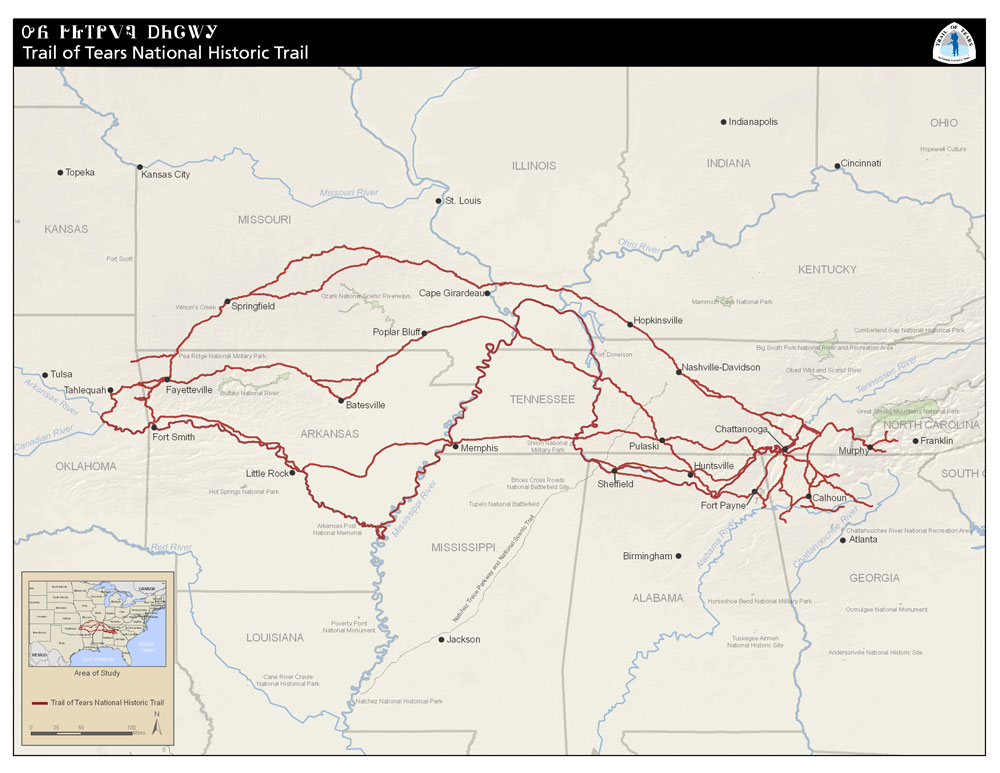
Trail of Tears NHT map courtesy NPS.
The Trail of Tears National Historic Trail commemorates the survival of the Cherokee people, forcefully removed from their homelands in Georgia, Alabama, and Tennessee to live in Indian Territory, now Oklahoma. They traveled by foot, horse, wagon, or steamboat in 1838-1839. Notable points of interest include the Museum of the Cherokee Indian, Moccasin Bend National Archaeological District, and Russel Cave National Monument. Discover additional points of interest along the trail here.
The Trail is not a clearly marked, nor is it a traditional, continuous hiking trail. Instead, it is a corridor that passes through communities and wild areas in different states and various types of land ownership. The trail extends from North Carolina through Tennessee, Georgia, Alabama, Kentucky, Illinois, Arkansas, Missouri, and ends in Oklahoma.